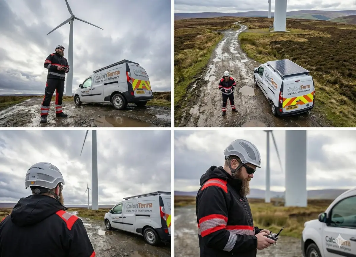
Beyond Standard Compliance
We understand that on a live site, "a guy with a drone" is a liability. CalonTerra is an external aviation unit. We operate under a strict Safety Case that exceeds standard requirements.
2-Person Crew (Mandatory)
We never fly solo on commercial sites. A dedicated Spotter maintains visual line of sight and situational awareness, allowing the Pilot to focus purely on data capture.
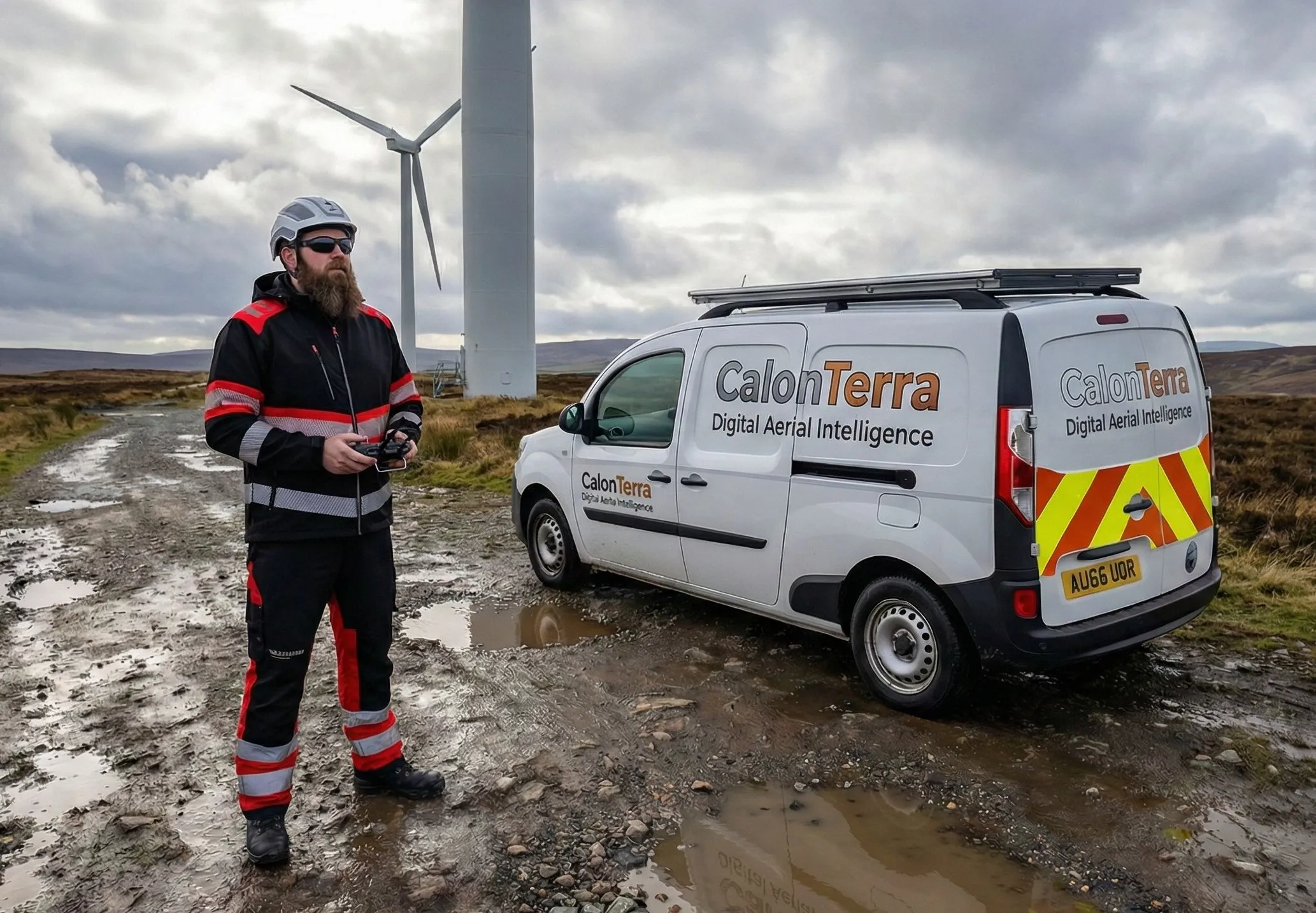
Chapter 8 Vehicles
Our fleet is equipped with Amber Beacons and Chapter 8 Chevrons for highway and site visibility. We are self-contained and site-ready upon arrival.
Level 3 PPE & Zones
Full site-specific clothing (Level 3 Red/Yellow). We establish physical Cordoned Flight Zones to segregate drone operations from site personnel.
Operational Workflow
Rigorous protocol from Invoice to Delivery.
1. Protection & Planning
We conduct a remote visual inspection (RVI) of the site. Insolvency Protection: Flight dates are confirmed only upon invoice settlement.
2. The Scout Flight
On arrival, we execute a 120m Vertical Scout directly above our vehicle to assess hazards before we even enter the site or engage management.
3. Site Handover
We report to the site office with completed RAMS. We confirm PPE requirements (Red/Yellow Hi-Vis) and conduct the specific site induction.
4. Deployment
We deploy from cordoned zones. Whether a 15-minute scan or a multi-day residency, we deliver raw data and reports via cloud link.
Technical & Payment FAQ
Why do you require payment before flight?
Due to the current economic climate in the construction sector, firm insolvency is a genuine risk. To protect our business, no flight operations will commence without the invoice being settled. This allows us to guarantee our availability and safety resources for your project.
What file formats do you deliver?
We deliver industry-standard formats ready for CAD/BIM integration: .LAZ / .LAS (Point Clouds), .OBJ (3D Mesh), .TIFF (Orthomosaics), and .DWG (via partner processing).
Can you fly in rain?
Our enterprise drones are IP-rated, but for Photogrammetry (Mapping), we require dry conditions and good light for data accuracy. We monitor weather 48hrs in advance and will reschedule at no cost.
Can you stay on site for multiple days?
Yes. For large infrastructure projects, we offer multi-day residencies. This allows for continuous progress monitoring. Accommodation and subsistence costs will be included in the commercial estimate.
Multi-Sensor Technology
4/3 Hasselblad CMOS
Primary sensor delivering 20MP Raw Imaging with exceptional dynamic range. Gold standard for photogrammetry.
70mm Telephoto
Compression lens for Facade Inspections, capturing high-detail textures of brickwork and cladding.
166mm High-Zoom
Safety optic. Powerful 7x optical zoom for inspecting high-risk assets from a safe stand-off distance.
Data Products
Highlighting our versatile range of aerial services.
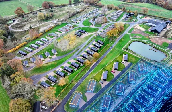
Digital Surface Models
Visualise site topography including vegetation. Ideal for line-of-sight analysis and flood modeling.
3D Textured Mesh
A full "Digital Twin." A navigable 3D object of your site, compatible with AutoCAD and Revit.
Volumetrics
Track earthworks and stockpile volumes efficiently to validate contractor claims.
Efficiency: The Commercial Edge
Reduce risk exposure and cut project access costs by up to 80%.
Reduced Downtime
Avoid site lockdowns. UAV flights minimize operational interruption compared to installing temporary works, cranes, or complex road closures.
Faster Data Handover
A full site scan is completed in hours, not days. This speeds up defect identification, repair quotes, and final sign-off timelines for asset managers.
Eliminate Costly Access
Skip MEWP (Mobile Elevating Work Platform) hire, rope access planning, and scaffold procurement. Drone data collection is the cost-effective first response.
Pricing Transparency
Flexible rates based on compliance and required scope.
Fee Adjustments
- Regional Location Factor: Quotes align with Spon's 2025 Price Book (e.g., London +18%).
- Travel Surcharge: First 20 miles free. Excess charged at £0.50 per mile.
- Road User Charging: Surcharges are calculated based on job postcode.
Service Scope Definitions
- Small Commercial Audit (£750 Fixed): Up to 4 hours on-site. Single asset focus (e.g., warehouse roof).
- Half Day Rate (£450): 08:00 - 12:00 or 13:00 - 17:00. Includes pre-flight RAMS.
- Full Day Rate (£850): Continuous monitoring or multi-asset inspection over 8 hours.
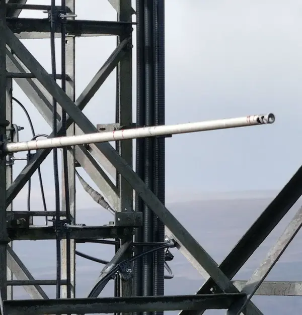
Recent Projects (Proof of Work)
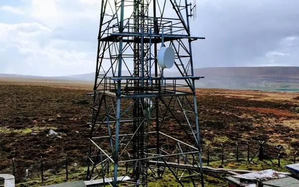
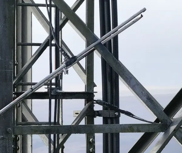
Blaenavon Telecom Mast
High-risk inspection of a 45m mast. Using zoom optics, we identified critical dipole damage.

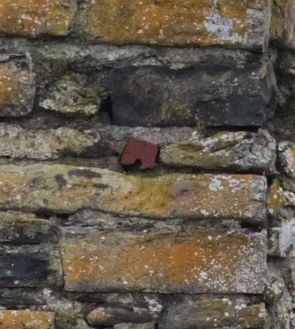
Aberystwyth Castle
Non-invasive survey of a Grade I listed heritage site. Captured millimetre-accurate data.

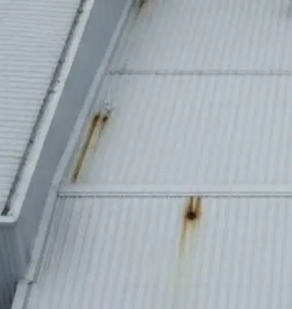
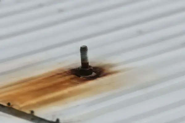
Commercial Facade
Rapid-deployment cladding inspection. Pinpointed water ingress.
Innovation Roadmap
The Future of CalonTerra (Estimated Q3 2027)
Stage 1: Ground Truth
Mapping the entire site and integrating your existing BIM models to create the foundational 4D Digital Twin.
Stage 2: Milestone Scans
Automated scans at critical path moments. Comparing as-built reality against the BIM for slab pouring.
Stage 3: Automated Progression
Our ultimate goal: fully autonomous weekly scans to track material stockpiles and verify health & safety.
"We are currently in a 12-month R&D contract with a local housing developer to build this AI analysis engine."
Core Inspection Capabilities
Highlighting our versatile range of aerial services.
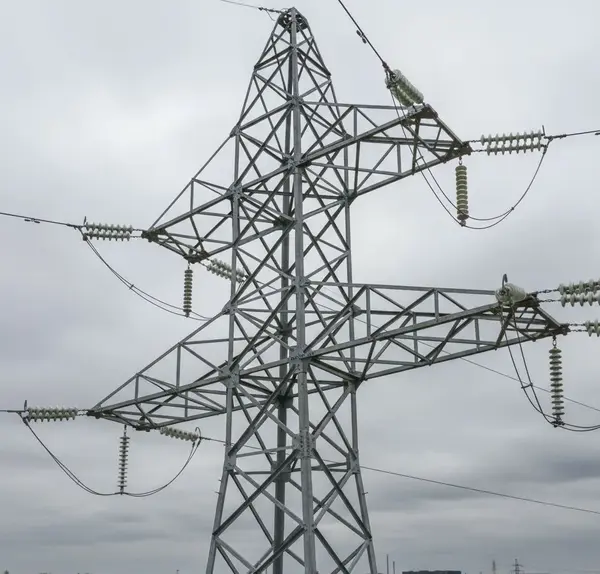
Energy & Utilities
Safe, stand-off inspection of HV pylons, wind turbines, and substations. High-Zoom Visual Analysis.
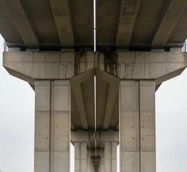
Infrastructure & Civil
Detailed structural analysis of bridges and viaducts. Delivering survey-grade data capture.

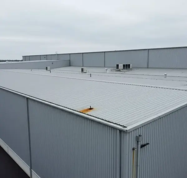
Structural & Commercial
Rapid-deployment condition reports pinpointing water ingress and facade defects. Ideal for Dilapidation Surveys.
Data Assurance Statement
Clarification of Role: CalonTerra is a specialist aerial data capture firm. We are not Chartered Surveyors (RICS) or Structural Engineers.
However, we operate to RICS-aligned standards for data capture quality. We provide the "Raw Truth"—high-fidelity, evidence-grade data that allows your qualified surveyors and engineers to make decisions without leaving the ground.
Request Commercial Rates
Direct line to our Chief Pilot. We typically respond within 2 hours.