The Gateway Specialists
From Blorenge wind tunnels to Sugar Loaf microclimates.
1. Heritage Quote
Submit your property address. We verify Conservation Area or Listed status before quoting.
2. Arrive & Pay
Payment only taken on-site after confirming wind conditions and heritage sensitivity.
3. The 20-Min Audit
Quiet, non-intrusive flight to map stone tiles, chimneys, and junctions without contact.
4. Heritage Data Package
PDF Condition Report + 4K images + Heritage Compliance Notes for planners or insurers.
The "Conservation Promise"
If your property is in a Conservation Area or is Listed, we follow strict non-intrusion protocols. If weather disrupts flight, you pay nothing.
*For NP7 postcodes and heritage-designated properties.
PRECISION AT THE GATEWAY
Abergavenny’s wind patterns demand expertise.
The Blorenge and Sugar Loaf create complex downdrafts that destabilize standard drones. We use CAA-authorised flight logic to maintain stability over heritage stone.
Our surveys are designed for clients who value preservation over repair:
- ✅ Listed Building Compliant: No physical contact, no disturbance.
- ✅ Stone Tile Delamination: Spot flaking before it slips.
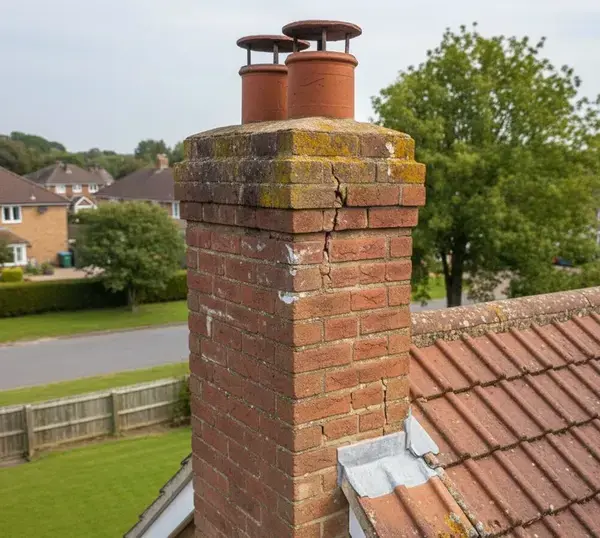
- ✅ Chimney Mortar Erosion: Critical for party-wall disputes.
Abergavenny: Market Town Fabric Under Mountain Weather
Listed stone in the town centre, fully exposed pitches under the Blorenge and the Sugar Loaf.
Conservation Area Roofscapes
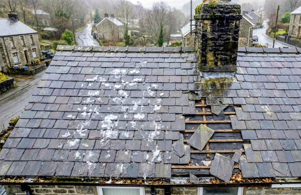
Frogmore Street, Cross Street and the lanes around St Mary's Priory carry listed and conservation-area buildings whose roofs nobody has properly examined in years: hidden valleys, lead gutters behind parapets, slate laid in diminishing courses. None of it is visible from the street, and all of it can be recorded from the air without touching the historic fabric.
Mountain Rainfall and Funnelled Wind
Abergavenny sits where the Usk valley narrows between the Blorenge, the Sugar Loaf and the Skirrid. Rainfall here runs well above the county average and the wind is funnelled rather than steady, so water gets driven into laps and joints that would stay perfectly dry on a sheltered site.
Llanfoist and Govilon Hillsides
Properties climbing the hill at Llanfoist and Govilon sit on ground that makes ladder work marginal and scaffolding costly. Most are stone-built with slate roofs and later extensions, so the vulnerable point is almost always the junction between old work and new. That junction photographs clearly from above and not at all from the drive.
A Surveyor, Not a Roofer
We hold no roofing contracts and take no referral fees, so the condition of your Abergavenny roof makes no difference to what we earn. A fixed fee buys the flight, every raw image, the 4K video and a written assessment — documentation you can put in front of a conservation officer, a lender or a builder.
Buying a Listed Home in Abergavenny?
"The survey missed the chimney condition."
Standard RICS reports often state "Roof not inspected – obscured from ground."
The Solution: Aerial evidence accepted by Monmouthshire County Council planning officers.
Insurance & Heritage Claims
Insurers require proof of recent storm damage on heritage properties.
- ✅ Date-stamped 4K evidence
- ✅ Non-invasive methodology
- ✅ Accepted by NFU, Heritage Insurance, and Ecclesiastical
Typical Defects We Expose
Stone Tile Delamination
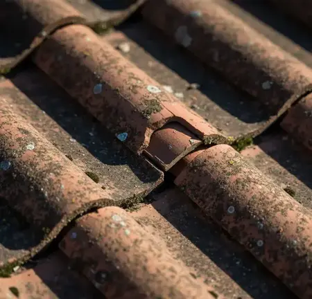
Flaking Cotswold/Welsh stone before it slips.
Chimney Mortar Erosion
Critical for party-wall disputes in terraces.
Valley Gutter Blockages
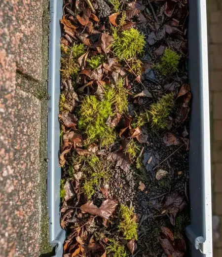
Hidden behind parapets on Georgian homes.
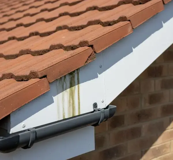
Timber Soffit Rot
From prolonged damp in Blorenge shadow zones.
Abergavenny Heritage Intelligence
Our drones are calibrated to spot specific defects common to the Gateway:
- Conservation Area Mapping: Flight paths approved by Monmouthshire Council
- Stone vs. Slate ID: Visual differentiation for repair matching
- Lead Valley Flashing: High-resolution checks for splits
- Auction Pre-Bids: Rapid condition reports for listed properties
Abergavenny Pricing
Zero Travel Cost for NP7. Heritage Surcharge Waived.
Basic Heritage Check
£165*
"Chimney condition only"
- • 15 Min Flight
- • Raw Images + Heritage Note
*Standard rate £145 + £20 heritage protocol
Full Heritage Audit
£285*
Most Popular.
- • Full Roof & Chimney Scan
- • PDF Heritage Condition Report
- • Defect Log for Planners
*Includes conservation compliance notes
Estate Agents
Volume
Heritage Property Marketing
- • Listed Building Reports
- • Auction Pre-Surveys
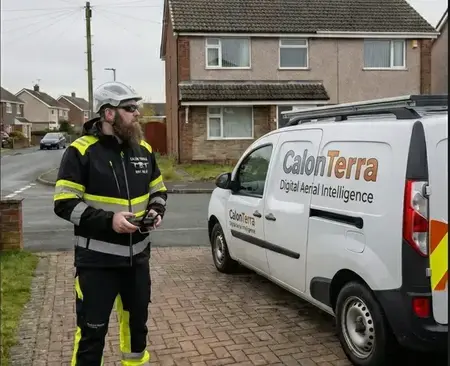
Pilot Certification & Insurance
Your assurance for a safe, compliant, and discreet survey.

CAA Operational Authorisation
UK CAA A2 Certificate of Competency (A2 CofC).
- ✅ Fully Insured: £5M Public Liability.
- ✅ Heritage Trained: Non-intrusive methodology for listed properties.
- ✅ GDPR Compliant: Data managed to strict ICO protocols.
Abergavenny Heritage Zones
Serving the Gateway to the Beacons with cultural sensitivity.
- 📍 Abergavenny Town: Conservation Core
- 📍 Llanfoist: Listed Riverside Cottages
- 📍 Govilon: Industrial Heritage
- 📍 Mardy: Farm Conversions
- 📍 Llanwenarth: Remote Stone Estates
- 📍 Llanellen: Valley Terrace Homes
Heritage Materials We Inspect
Book Your Abergavenny Heritage Survey
Mention "Listed Building" for priority scheduling.
Abergavenny Drone Surveys: NP7 Questions
What Abergavenny, Llanfoist, Govilon and Mardy customers ask.
Can you fly inside the national park boundary?
Yes. National park designation restricts development, not aerial survey. We do plan around livestock, footpath users and nesting seasons on the upland fringes above Llanfoist and Govilon, but that is ordinary airmanship rather than a permission problem.
Do you survey listed buildings in the town centre?
Frequently. A listed roof is exactly where non-contact survey earns its keep: no scaffold ties driven into historic stone, no consent application, and a photographic record of the hidden valleys and parapet gutters responsible for most heritage water ingress.
The market and Frogmore Street get busy. When would you fly?
Early morning, or on a quieter weekday. Flying over a busy street means overflying people who have not consented to the operation, so we schedule around market days and pick a launch point away from the footfall.
Can you check a farmhouse and its outbuildings together?
Yes, and around Mardy, Llanvihangel and Govilon that is the usual request. A farmhouse plus barns, stables and a machinery shed can be flown in one sortie, with each roof reported separately so you can prioritise where the money goes.
How much of Monmouthshire do you cover?
Abergavenny, Llanfoist, Govilon, Gilwern, Mardy and the Llanover side are standard coverage from our Pontypool base, along with Usk, Raglan and Monmouth. Travel is calculated for your postcode in the quote form on this page.